
Big Divides on the Great Divide
Big Divides on the Great Divide
A few thoughts on bikepacking in Canada
The narrative description on the Great Divide Mountain Bike map describes the section just north of the Canadian border as the “Serengeti of North America” meaning there are a lot of (predatory) large animals. I’m not usually one to be spooked by wildlife. I’ve spent a lot of nights protected by a single layer of nylon in bear country and, well, I’m still here. But something about it being Canada made me a little nervous. Everything is bigger in Canada, right? The mountains, the glaciers, even the bears?

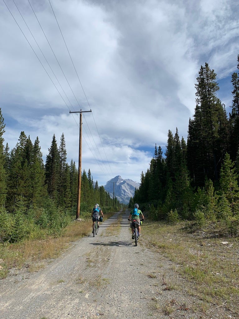
A few weeks ago Jamie and I joined a few friends to bike from Banff, Alberta to Roosville, British Columbia along the Great Divide. This is just a small section of the route, which stretches from Jasper, Alberta, to the Mexican border. The section we did is a mix of trail and dirt road with a little bit of pavement to string things together. We rode mountain bikes, although the differences between the four bikes we had were a testament to the wide range of what a “mountain bike” can be, and proof that really, the best bike for a trip like this (or maybe any bike trip) is the bike you like to ride.
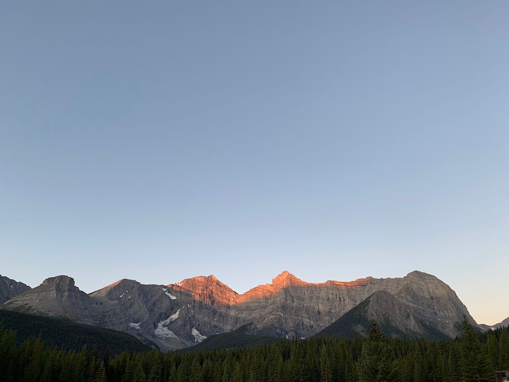
As we made our way south, out of Banff National Park and into a series of provincial parks and then into forested “crown land” I found myself filled with a sense of anticipation for arrival that never quite manifested. It was absolutely spectacular, the near-vertical mountain walls dotted with glaciers seemed close enough to touch. Unlike in Montana, there is no transition zone, no brushy hillsides that fade to alpine tundra that fade to rocky summits. The peaks here begin a few hundred feet above the valley floor and thrust skyward, refusing to be ignored. The valley bottoms are gently sloping and thickly treed, and crawling with people. It felt like we never fully removed ourselves from the world of humans and entered a place where we were visitors. I couldn’t help but wonder where the bears were. Surely they weren’t up in all that rock, but with the valley bottoms choked with people, or signs of people, it was hard to imagine them slipping around in the shadows around us there either.
I was wide awake a few hours before dawn on the fourth day, and for a while, I couldn’t figure out what had woken me. We were camped next to a little lake, just off a dirt road which we had ridden for hours the day before and only seen two cars. We hadn’t seen a paved road since the day before. But there was a hum in the distance, that sounded like a city. It was the kind of hum that you feel more than hear. An hour or so into our ride that morning I realized the hillside emerging from the fog across the valley was the source of the hum, it was a coal mine that stretched from horizon to horizon and trucks and excavators crawled up and down its slopes like ants.

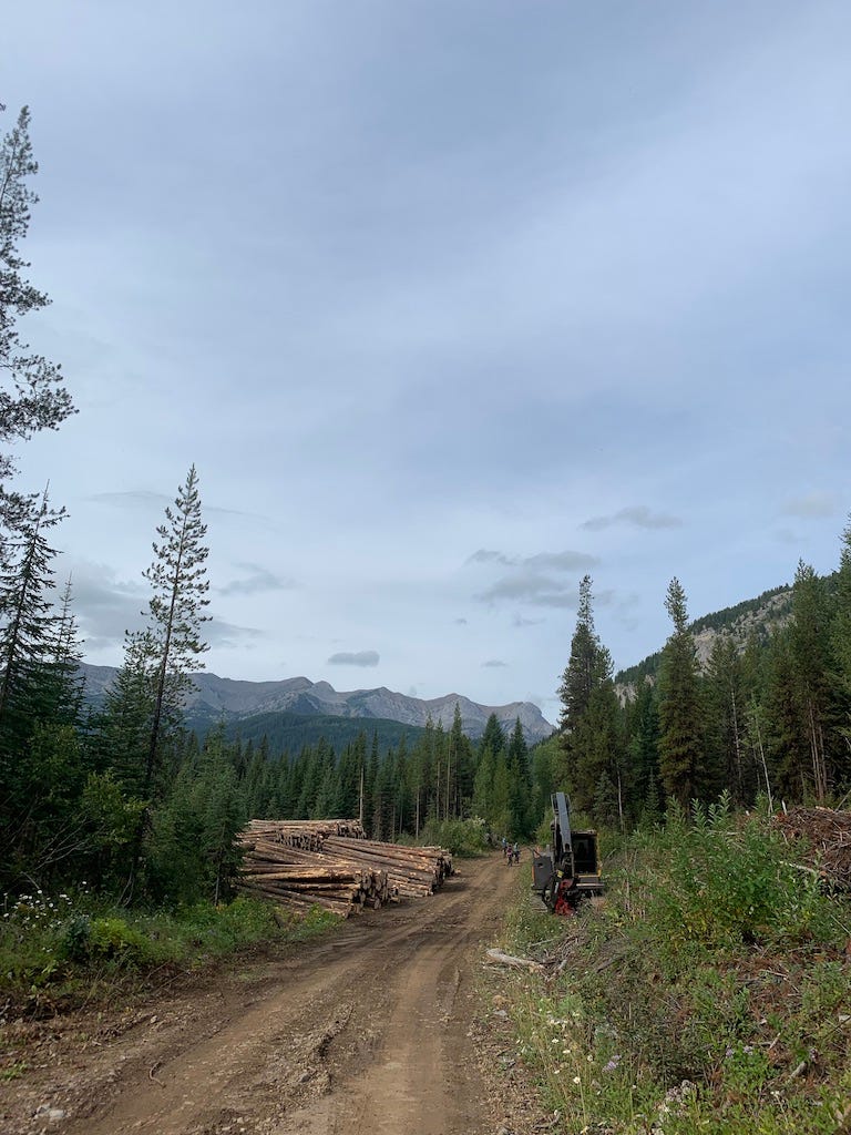
In Montana large-scale logging feels like a thing of the past. The infrastructure is there but you don’t see recent clear cuts chewing up the landscape and a lot of the roads are slowly being reclaimed by the landscape around them. On the fifth day of the trip, we crossed into the upper North Fork of the Flathead drainage, which continues south across the border where it becomes the western border of Glacier National Park. In the upper North Fork, the presence of logging was everywhere. The roads were wide and people drove fast. Clearcuts, in various stages, from active with freshly bared soil, to grown over and weedy, were a constant. For all our worry about predators we hardly even saw any sign of bears.
The contrast to the North Fork I know and love south of the border was stark and prompted me to do a little research when we returned home. It turns out, laws that allow citizens to sue government agencies to force them to enforce environmental laws, and laws that create mandatory public comment periods do make a difference. All this is not to say the Great Divide isn’t worth the time. I loved how much ground we covered on wheels (as opposed to on foot) and it was fun to think about roads as routes for exploration, not just a means to get where we were going. It may have been less wild than expected but I think it was also more foreign than I expected. I’m already scheming about a trip back to Banff to stare at those mountains some more.
A few more things:
I have some complicated feelings about making our maps available digitally, and a lot of opinions about the way people interface with the world when they are following a blue dot which I’ll probably write about more at some point. But, we finally did it.
On a related note: A Fire Lookout on What’s Lost in the Transition to Technology
I thought a lot about borders on our Great Divide trip. Arbitrary lines cut rivers in half right next to rugged mountain ranges that form the most impenetrable border you could imagine. How much of our angst around borders stems from trying to impose straight lines on complex landscapes? I loved this video which humanizes the southern border through running.
Finally, we’re headed to Tacoma and Seattle for the North American Cartographic Society’s annual conference in a couple of weeks. What should we see and do? Where should we eat?
Thanks for reading!